Planned or prescribed burning is widespread in forests and grasslands across Australia. The primary aims of these programs are for:
- hazard or fuel reduction: prescribed burning is used to reduce the amount of fuel in order to reduce the intensity, rate of spread and size of subsequent unplanned fires. These effects potentially increase opportunities for safe and effective suppression of bushfires. Risk to human communities, built assets, infrastructure and livelihoods is therefore potentially reduced. Or,
- environmental management: use of prescribed fire to alter fire regimes to reduce risks to biodiversity, ecosystem processes and natural resources, via changes to the incidence, intensity and area burned by unplanned fires.
Current land management practices focus on risk-based approaches for prescribed burning, which is consistent with the approach outlined in the National Disaster Risk Reduction Framework, where one of the guiding principles is that “All sectors have shared but defined responsibilities to reduce disaster risk.” The Framework is also clear that there is a requirement that “data and information informs implementation planning and execution”.
Project aims
The principal purpose of the Atlas is to provide a comprehensive, formal estimation of risk to key human and environmental values across southern Australia. The information available through this Atlas, supports the following priorities and actions for the Framework:
Priority 1: Understand disaster risk
- Identify and address data, information, and resource gaps
- Address technical barriers to data and information sharing and availability
- Integrate plausible future scenarios into planning
Priority 2: Accountable decisions
- Consider potential avoided loss (tangible and intangible) and broader benefits in all relevant decisions
- Build the capability and capacity of decision-makers to actively address disaster risk in policy, program, and investment decisions
Methods
In attempts to provide a formal quantitative system for assessing the effectiveness of prescribed burning, this project explored the effects of various temporal and spatial arrangements of burning on hundreds of thousands of wildfire simulations and associated fire behaviour. We examined the impacts of wildfire simulations in different locations (including cost of lives, property and landscape) and estimated the risk mitigation of different prescribed burning treatments to find the most cost-effective strategies.

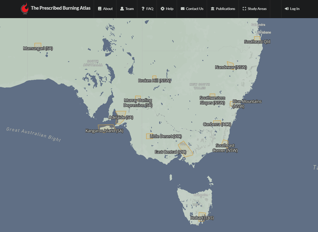
Fire simulations were completed for 13 areas across Australia: southeast Queensland; Nandewar, Broken Hill, Southwestern Slopes, Blue Mountains and Southeast Corner, NSW; Canberra, ACT; Little Desert and East Central, Victoria; Hobart, Tasmania; Murray Darling Depression, Adelaide and Mamungari, South Australia.
Results
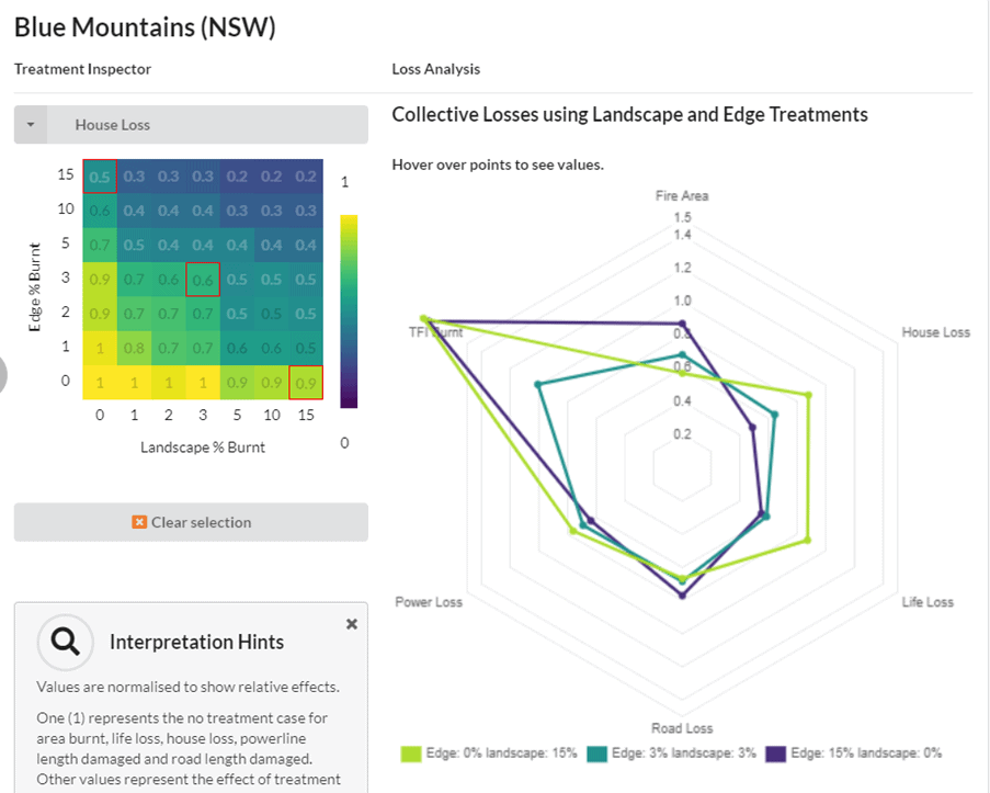
A key finding of the research was that the effectiveness of prescribed burning at mitigating risk from wildfire varies considerably across landscapes and is not a ‘one size fits all’ approach. The Prescribed Burning Atlas is a new website that informs prescribed burning strategies and helps fire and land managers tailor their approaches to outcomes that will best reduce risk in a target area within available budgets.

A comparison of three different prescribed burning treatment options in the Blue Mountains. Green – 15% of the landscape burnt and 0% edge burnt. Purple – 0% of the landscape and 15% of the edge burnt. Aqua – 3% of the landscape burnt and 3% edge burnt